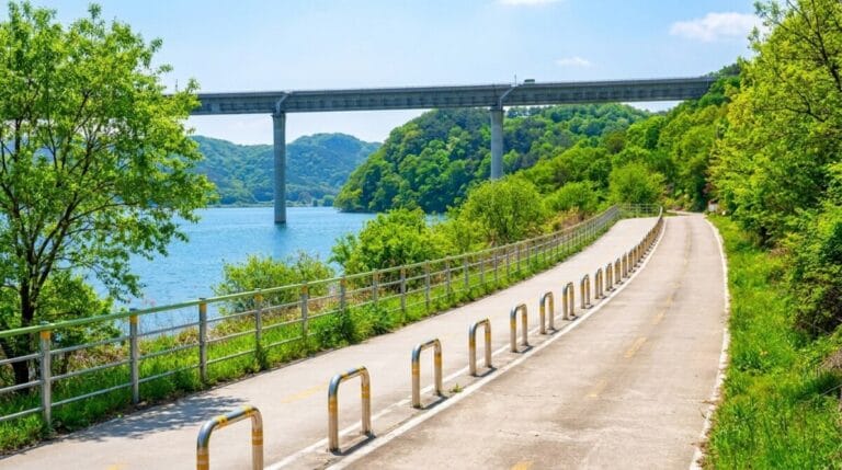
Somewhere around Neungnae Station, on the old rail bed that used to carry the Jungang Line, I stopped pedaling and just stood there for a minute. There’s a platform preserved almost exactly as it was, benches still bolted down, and a small memorial to Dasan Jeong Yak-yong nearby. No train has passed through in years, but the rails are still there under your wheels if you look down. It’s one of those moments that makes you forget you’re 40 kilometers into a ride that’s only a third finished.
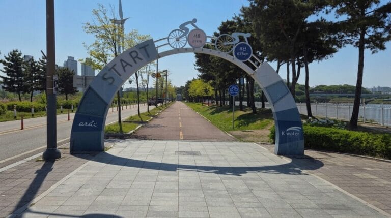
This is route number ten in Korea’s national cycling system, and it’s the one that actually earns the word “epic.” If you’ve read the beginner’s guide to Korea’s national cycling routes and ridden the Ara Bicycle Path, you’re standing at Ara Hangang Lock with 192 kilometers of the Hangang Bicycle Path ahead of you. This post covers both halves of it: the flat, park-like run through Seoul, and the longer haul up the South Han River toward Chungju. I’m not going to repeat the passport or navigation basics here, so if you skipped the first post, go back for that part first.
What the Hangang Bicycle Path Actually Is
The Hangang Bicycle Path runs 192 kilometers from the Ara Hangang Lock, right where the Ara Bicycle Path hands off, to the Chungju Dam Certification Center deep in North Chungcheong Province. Officially it splits into two distinct personalities. The first 56 kilometers, known locally as the Seoul section, hug both banks of the Han River through the capital, past Yeouido, the Jamsil area, and out to Paldang Bridge on the city’s eastern edge. From there, the South Han River section takes over for the remaining 132 to 139 kilometers, tracing the river through Namyangju, Yangpyeong, and Yeoju before finishing near Chungju.
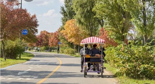
The two halves feel like different rides entirely. The Seoul section is wide, paved, and crowded with joggers, families, and commuters on weekends. The South Han River section thins out fast, swaps riverside parks for converted railway beds and quiet farm roads, and starts asking more of your legs the further west you get from Yangpyeong.
Key Points on the Map
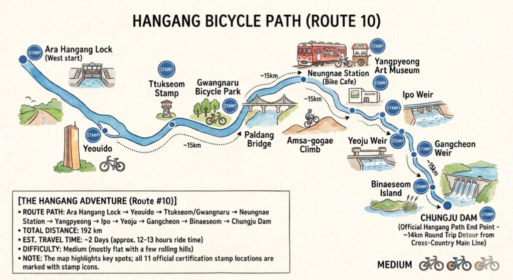
[Insert route map graphic here: Ara Hangang Lock → Yeouido → Ttukseom/Gwangnaru → Paldang Bridge → Neungnae Station → Yangpyeong → Ipo Weir → Yeoju Weir → Gangcheon Weir → Binaeseom → Chungju Dam]
Here’s the full lineup in the order you’ll reach them, with the certification stops marked:
- Ara Hangang Lock (start, shared with the Ara Bicycle Path) — Google Maps · Naver Map
- Yeouido Certification Center — Naver Map
- Ttukseom Resort Complex / Gwangnaru Bicycle Park (either stamp counts) — Naver Map
- Paldang Bridge (Seoul section ends here) — Naver Map
- Neungnae Station Certification Center — Naver Map
- Yangpyeong County Art Museum Certification Center — Naver Map
- Ipo Weir Certification Center — Naver Map
- Yeoju Weir Certification Center — Naver Map
- Gangcheon Weir Certification Center — Naver Map
- Binaeseom Certification Center — Naver Map
- Chungju Dam Certification Center (optional detour, see below) — Naver Map
Difficulty and How Long It Actually Takes
Officially this route clocks in around 12 hours and 40 minutes of total riding time, which sounds brutal until you realize almost nobody does it in one sitting. Most riders split it into two full days, sleeping somewhere around Yangpyeong or Yeoju in between. The Seoul section alone is about three hours and forty minutes at a relaxed pace, flat enough to pair with the Ara Bicycle Path as a single long day if you’re feeling ambitious. The South Han River section runs closer to eight to nine hours on its own and is where the route earns its difficulty rating, somewhere in the middle of the twelve certified paths rather than at the easy end like Ara.
There are two short, sharp climbs waiting right at the edge of Seoul: Mieumnaru-gogae on the north bank and Amsa-gogae on the south bank. You only need to cross one, whichever side of the river you’re riding. Amsa-gogae is the gentler of the two and the one most first-timers default to. Past Yangpyeong, the terrain rolls again near Huimigae-gogae, and a third climb, Changnam-gogae, shows up close to Gangcheon Weir. None of these are mountain-pass territory, but after 100-plus kilometers they’ll remind your legs they exist.
The stretch past Gangcheon Weir is the one to plan around carefully. The dedicated bike path thins out here, and you’ll spend more time on shared farm roads and local roads with light traffic. Convenience stores and rest stops get noticeably scarcer too, so this is not the section to run low on water.
The Certification Centers on the Hangang Bicycle Path
There are nine certification stops across the full route, not counting Ara Hangang Lock, which you’ll have already stamped if you rode the Ara path first.
Seoul Section: Yeouido and Ttukseom / Gwangnaru
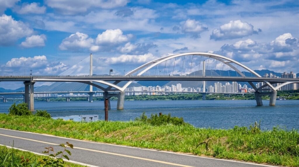
The Yeouido Certification Center sits inside Yeouido Hangang Park, one of the busiest stretches of riverside in the entire country. Expect crowds, food trucks, and a genuine carnival atmosphere on weekends. Further east, Ttukseom Resort Complex on the north bank and Gwangnaru Bicycle Park on the south bank sit almost directly across the river from each other, and here’s the useful part: their stamps are interchangeable. Get one and the system counts the other automatically, so you don’t need to detour across a bridge just to collect both.
South Han River Section: Neungnae to Chungju Dam
Neungnae Station is the standout stop on this half, a preserved former railway station with a convenience store, restaurants, a bike shop, and restrooms all within easy reach. The Yangpyeong County Art Museum center that follows has no real amenities of its own, but it drops you right into downtown Yangpyeong, so supplies aren’t an issue. Ipo Weir has a small shop and nearby restaurants. Yeoju Weir and Gangcheon Weir both have convenience stores and restrooms but little else, and Binaeseom, the last stop before the terrain gets lonelier, has both a restaurant and a shop worth stocking up at.
Chungju Dam deserves its own note. It sits about seven kilometers off the main national cross-country line, meaning you’d ride fourteen extra kilometers round trip just to reach it. Skip it if you’re only chasing the Incheon-to-Busan crossing certification, since it isn’t required for that. But if you want the Hangang Bicycle Path certification specifically, or you’re going for the full grand slam across all twelve routes, this stamp is mandatory, and there’s no way around the detour. Riders who’ve done both regrets say the same thing: just go get the stamp now, because coming back for it later is worse.
Do You Need a Place to Sleep on This Section?
Yes, almost certainly, unless you’re only riding the Seoul section on its own. At 192 kilometers total, this is a two-day route for the vast majority of riders, and Yangpyeong or Yeoju are the natural places to break the trip. Both towns have motels and guesthouses within a short ride of the path, and both sit roughly at the halfway point depending on how far you push on day one. If you’re pairing this with the Ara Bicycle Path as day one and continuing into the South Han River section on day two, Yangpyeong is the more natural stopping point given the distances involved.
Where to Eat Along the Way
The Seoul section is the easiest stretch of the entire national route to eat well on. Convenience stores line the path every few hundred meters, and both Yeouido and the Ttukseom area have full restaurant clusters a short walk from the bike lane. Near Paldang, right where the Seoul section ends, look for chogye guksu, a cold noodle dish in a tangy, slightly sweet broth that’s become something of a local specialty around the Paldang area specifically.
Once you’re on the South Han River section, supply gets progressively more spread out. Neungnae Station, Yangpyeong town, Ipo Weir, and Binaeseom all have real food options. Past Gangcheon Weir, though, plan ahead. Convenience stores thin out fast, and the small village shops you’ll pass aren’t guaranteed to be open. Carry more water and snacks than you think you’ll need through this final stretch toward Chungju.
Getting to the Starting Point
If you’re continuing straight from the Ara Bicycle Path onto the Hangang Bicycle Path, you’re already at the start, since Ara Hangang Lock is the shared endpoint between the two routes. If you’re starting fresh, the nearest subway access points are Gayang and Banghwa stations on Seoul’s Line 9, both a short ride from the path along the river. Weekday off-peak hours are your best bet for bringing a full-size bike onto the subway without hassle.
Worth Slowing Down For
Dumulmeori, just past Yangpyeong, is the one stop on this entire route you shouldn’t rush through. It’s where the North and South Han Rivers physically meet, marked by a 400-year-old zelkova tree and a small wooden boat that’s become one of the most photographed spots in the country. Early morning brings river mist and a soft gold sunrise that’s worth setting an alarm for if you’re staying nearby. Grab a yeon hotdog, a lotus-flour corn dog that’s become the local specialty snack here, before you push on.
Between Neungnae and Yangpyeong, the path runs through eight converted railway tunnels from the old Jungang Line, including the Gigok Art Tunnel, one of the longest in the area, where color-changing LEDs light the walls as you ride through. Near Yeoju, a two-kilometer detour off the main path leads to the Tomb of King Sejong, the Joseon-era king who created the Korean alphabet, and the tomb complex is recognized as a UNESCO World Heritage site alongside Korea’s other royal tombs.
Quick Summary
Here’s the Hangang Bicycle Path at a glance, from Ara Hangang Lock to Chungju Dam.
- Distance: 192 km total (Seoul section 56 km, South Han River section 132–139 km)
- Time: about 12 hours 40 minutes of riding, almost always split across 2 days
- Difficulty: mid-range — flat through Seoul, rolling hills and shared farm roads past Yangpyeong
- Stamps: 9 total, including one optional detour (Chungju Dam, +14 km round trip, required only for the Hangang or grand slam certification)
- Lodging: needed for most riders — Yangpyeong or Yeoju are the natural overnight stops
- Food: abundant through Seoul and as far as Binaeseom; carry extra water and snacks past Gangcheon Weir
- Access: Gayang or Banghwa Station (Seoul Line 9) for a fresh start, or continue directly from the Ara Bicycle Path
- Watch for: Amsa-gogae or Mieumnaru-gogae near Seoul, and Changnam-gogae near Gangcheon Weir
This is where the Hangang Bicycle Path stops being a scenic warm-up and starts feeling like an actual journey. Next up: the Saejae Bicycle Path, where the ride climbs over Ihwaryeong Pass to reach the Nakdong River basin.