TThe tunnel at Ihwaryeong is the kind of place that makes you talk to yourself. I remember stopping just past the portal, chest still heaving from the climb, and reading the old sign about how the pass got its name: Saejae, they say, means a mountain so high that even birds have a hard time crossing it. Standing there with my legs shaking and my water bottle nearly empty, I believed every word of it. Tigers used to live in these mountains too, and travelers on the old royal road crossed in groups for safety. I crossed alone, on a bicycle, and it still felt like an accomplishment worth the ache.
If you’ve followed this series through the beginner’s guide to Korea’s national cycling routes, the Ara Bicycle Path, and the Hangang Bicycle Path, you already know the rhythm of these certification rides. This post is different in tone. The Saejae Bicycle Path is short by Korean standards, just 100 kilometers, but it packs in the two toughest climbs on the entire certified network. This is the route that separates the riders who came for a pleasant weekend from the ones chasing the full Incheon-to-Busan crossing.
What the Saejae Bicycle Path Actually Is
The Saejae Bicycle Path picks up exactly where the Hangang Bicycle Path leaves off, at Chungju Tangeumdae, a riverside terrace and park near the center of Chungju City. From there it runs 100 kilometers south to Sangju Sangpung Bridge, where it hands off to the Nakdonggang Bicycle Path for the final leg down to Busan. Despite being the shortest of the four cross-country routes, it’s widely considered the hardest, and the reason comes down to geography rather than distance.
The Saejae Bicycle Path takes its name from Mungyeong Saejae, the historic mountain pass that once carried the Great Yeongnam Road, the main highway connecting the Joseon-era capital in Seoul to the southeastern Yeongnam region and the port at Dongnae, near modern Busan. This is the only stretch on the entire cross-country route that leaves the river valleys behind entirely and climbs over a mountain ridge to get from the Han River basin to the Nakdong River basin.
Two passes stand between Chungju and Mungyeong: Sojo Pass first, then the taller Ihwaryeong, or Ihwa Pass, before the Saejae Bicycle Path drops back down toward Sangju.
Key Points on the Map
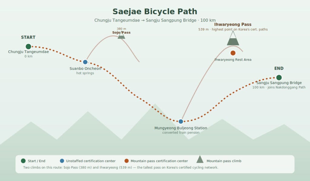
Here’s the full lineup in the order you’ll reach them, with the certification stops marked:
- Chungju Tangeumdae (start, hands off from the Hangang Bicycle Path, staffed) — Naver Map
- Suanbo Oncheon Certification Center (unstaffed) — Naver Map
- Sojo Pass (380m, first climb, no certification stamp here) — Naver Map
- Ihwaryeong Rest Area Certification Center (539m, highest point on the route, unstaffed) — Naver Map
- Mungyeong Buljeong Station Certification Center (unstaffed) — Naver Map
- Sangju Sangpung Bridge Certification Center (end, hands off to the Nakdonggang Bicycle Path, staffed) — Naver Map
Difficulty and How Long It Actually Takes
At 100 kilometers, the Saejae Bicycle Path is short enough that most reasonably fit riders can finish it in a single long day, somewhere around six to seven hours of actual riding time. But don’t let the distance fool you into treating it like an easy afternoon.
The Saejae Bicycle Path is consistently ranked as the toughest of Korea’s certified cycling paths, and the reason sits entirely in two climbs packed into the first half of the route.
Sojo Pass comes first, topping out at 380 meters above sea level with a gain of roughly 139 meters from the valley floor. It’s a real climb, but it’s really just the warm-up.
Ihwaryeong follows not long after, and at 539 meters it’s the highest point on any of Korea’s certified cycling routes, with a climb of around 305 meters. The road up is well engineered, with rest decks spaced roughly every kilometer so you have a legitimate excuse to stop, catch your breath, and look back at how far you’ve come. Traffic isn’t heavy through here, but keep an ear out for farm trucks taking the curves faster than you’d expect.
Past Ihwaryeong, the Saejae Bicycle Path drops through Mungyeong and flattens out considerably for the run down to Sangju, so the second half of the ride is far more forgiving than the first. Riders who’ve done the whole cross-country crossing tend to agree on the same piece of advice: don’t schedule anything demanding for the day after you cross Ihwaryeong.
The Certification Centers on the Saejae Bicycle Path

There are five certification stops on the Saejae Bicycle Path, and only two of them are staffed, which is fewer than you’ll find on either the Ara or Hangang paths. Plan your passport purchase around that.
Chungju to Suanbo: The Warm-Up
Chungju Tangeumdae is a staffed center, and if you’re arriving fresh rather than continuing straight off the Hangang path, this is where you’ll want to pick up your passport if you haven’t already. The terrace itself sits above the Han River with a small park and some historic markers worth a quick look before you set off.
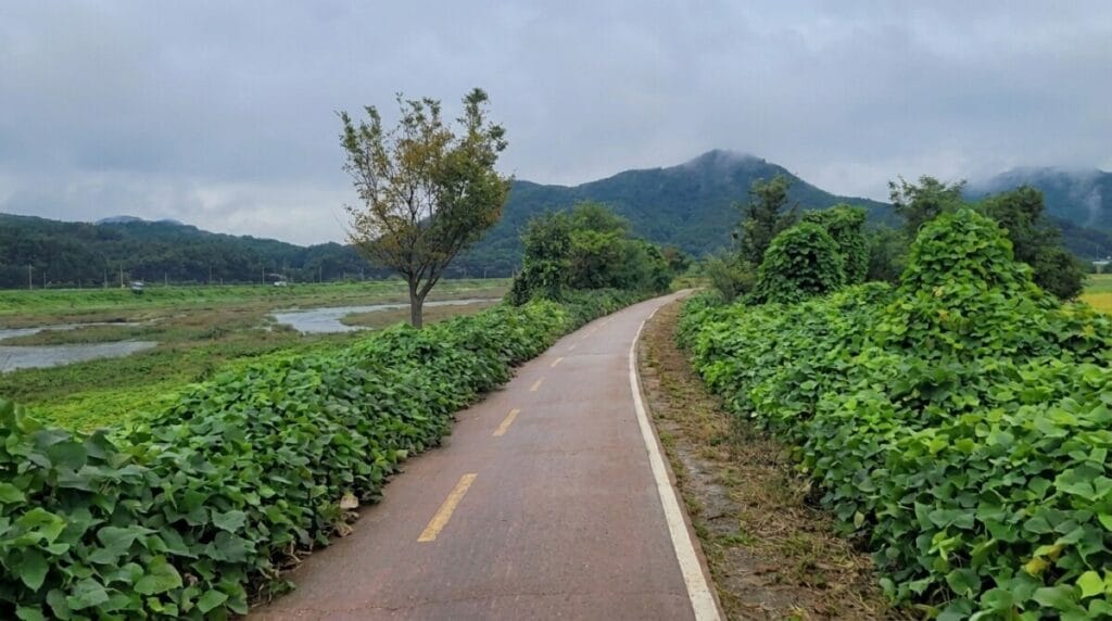
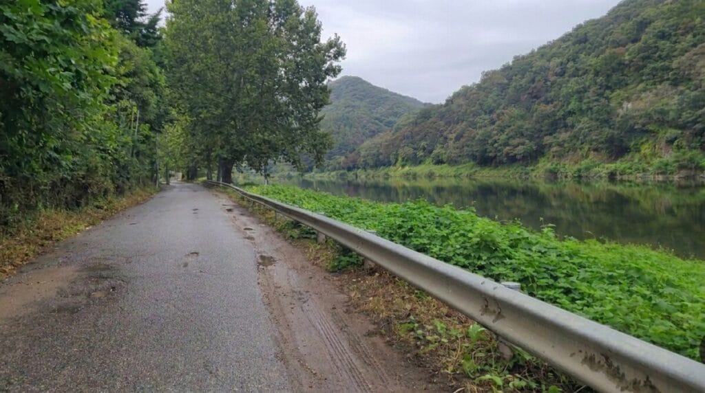
From there, the Saejae Bicycle Path eases you in gently, following the Dal Stream through farmland before the hot spring town of Suanbo comes into view. Suanbo Oncheon’s certification booth is unstaffed, a simple stamp station, but the town around it has been a hot spring destination for generations and makes an excellent overnight stop if you’re splitting the ride across two days.
Over the Passes: Sojo and Ihwaryeong
Sojo Pass doesn’t have its own certification stamp, but it’s very much part of the ride, and you’ll feel it in your legs before you reach the second, taller climb. Ihwaryeong Rest Area sits right at the summit, next to a small shop, vending machines, and a restaurant, which makes it one of the better-equipped rest stops on the entire Saejae Bicycle Path despite being unstaffed for certification purposes.
The tunnel through the mountain marks the border between North Chungcheong Province and North Gyeongsang Province, so crossing it means you’ve officially left the Han River side of the country behind.
Mungyeong and the Run to Sangju
Mungyeong Buljeong Station is one of the more memorable stops on the Saejae Bicycle Path, a former railway station repurposed with a genuinely charming twist: old train cars converted into overnight pensions, complete with kitchenettes and air conditioning, sitting right beside the certification booth. From here the terrain eases considerably as the path follows the Yeonggang River toward Sangju.
Sangju Sangpung Bridge Certification Center closes out the route, staffed and ready to sell passports to anyone continuing onward, since this is also where the Nakdonggang Bicycle Path officially begins.
Do You Need a Place to Sleep on This Section?
Strong riders can finish the Saejae Bicycle Path in one day, especially if they start early and treat the climbs as the day’s main event rather than an obstacle. That said, splitting it across two days is common and arguably the smarter move, particularly if you’re combining it with the Hangang path the day before and don’t want back-to-back long rides.
Suanbo is the natural overnight stop on the Saejae Bicycle Path, sitting just before the two big climbs, with a genuine hot spring culture that makes for one of the better recovery nights anywhere along the entire cross-country route. Soaking tired legs in a mineral bath the evening before tackling Ihwaryeong is about as good a strategy as this trip offers.
Where to Eat Along the Way
Chungju and Suanbo both have full restaurant options, and Suanbo in particular has built an entire small hospitality economy around its hot springs, so food isn’t a concern for the first third of the Saejae Bicycle Path. Once you’re past Suanbo and climbing toward the passes, options thin out fast.
The Ihwaryeong Rest Area has a small shop and a restaurant, which makes it worth timing a proper meal or snack stop right at the summit rather than pushing on hungry. Past the pass, Mungyeong town and the area around Buljeong Station have restaurants again, and Sangju offers a full range of options once you’ve finished the route.
Between Suanbo and Ihwaryeong specifically, carry more food and water than feels necessary, since this is the longest genuinely sparse stretch on the whole route.
Getting to the Starting Point
If you’re continuing straight from the Hangang Bicycle Path, you’re already at the start of the Saejae Bicycle Path, since Chungju Tangeumdae is the natural continuation once you’ve detoured to Chungju Dam or simply ridden the South Han River section to its end.
If you’re starting fresh, Chungju is reachable by intercity bus from Seoul’s Dong Seoul Bus Terminal in a little over an hour, and the bus terminal is a manageable ride from Tangeumdae itself. There’s no direct train service into central Chungju, so the bus is genuinely the more practical option for most riders arriving from Seoul.
Worth Slowing Down For
Tangeumdae itself deserves a slower look before you set off. It’s named for Ureuk, the Silla-era musician credited with inventing the gayageum, Korea’s traditional twelve-string zither, and the terrace above the river is said to be where he played and taught. It’s a peaceful spot to collect yourself before the ride ahead, with river views that make for a good final photo before the terrain turns serious.
Suok Falls, just south of Sojo Pass, is a small twenty-meter waterfall tucked just off the main path, easy to miss if you’re focused on the climb ahead but worth the short detour if your legs have anything left in them. Yeonpung Village, between the two passes, has a small Catholic cathedral that feels almost out of place among the mountain scenery, a quiet reminder of how varied Korea’s rural religious history actually is.
And if you have any energy left after Ihwaryeong, Mungyeong Saejae Provincial Park is worth a proper stop rather than a passing glance. The reconstructed fortress gates and stone battlements mark the actual historic pass the entire route is named for, and walking through the gatehouse gives you a real sense of what travelers on the old royal road were dealing with, minus the tigers.
Quick Summary
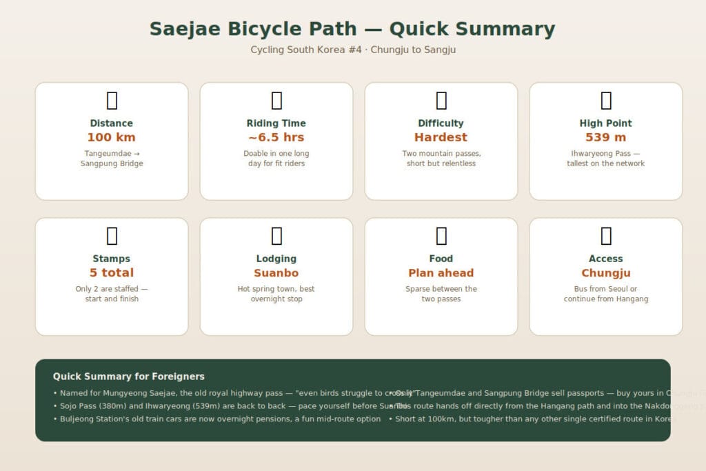
Here’s the Saejae Bicycle Path at a glance, from Chungju Tangeumdae to Sangju Sangpung Bridge.
- Distance: 100 km total
- Time: about 6–7 hours of riding, doable in one day for fit riders, often split at Suanbo
- Difficulty: hardest of the four cross-country certification paths, despite the short distance
- Stamps: 5 total, only 2 staffed (Chungju Tangeumdae and Sangju Sangpung Bridge)
- Climbs: Sojo Pass (380m) followed by Ihwaryeong (539m), the highest point on Korea’s certified network
- Lodging: Suanbo is the natural overnight stop, with hot springs for recovery before the passes
- Food: reliable through Chungju and Suanbo; carry extra between Suanbo and Ihwaryeong
- Access: intercity bus from Seoul’s Dong Seoul Terminal to Chungju, or continue directly from the Hangang Bicycle Path
- Watch for: farm trucks on the pass roads, and pace yourself for Ihwaryeong before you’re tired from Sojo
The Saejae Bicycle Path is where the cross-country route stops being scenic and starts being earned. Everything after Ihwaryeong feels different, lighter somehow, like the mountains gave their approval and let you through. Next up: the Nakdonggang Bicycle Path, the longest single leg of the journey, following Korea’s longest river all the way down to Busan.