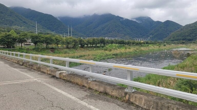
I stood at the bottom of Maehyupjae with both feet already off the pedals, walking my bike up a grade that the sign at the base didn’t even bother softening: over 20 percent, straight up a farm road studded with pinecones and loose gravel. Ihwaryeong, the pass that closed out the Saejae Bicycle Path, had rest decks and a paved shoulder. Maehyupjae has none of that.
It has about four hundred meters of pure incline and a view over the Nakdong River at the top that makes you forget your calves are shaking. This is how the Nakdonggang Bicycle Path introduces itself: no warning, no easing in. I’ve heard riders call this the steepest stretch on the entire cross-country route, steeper than Ihwaryeong, steeper than anything on the Hangang. They might be right.
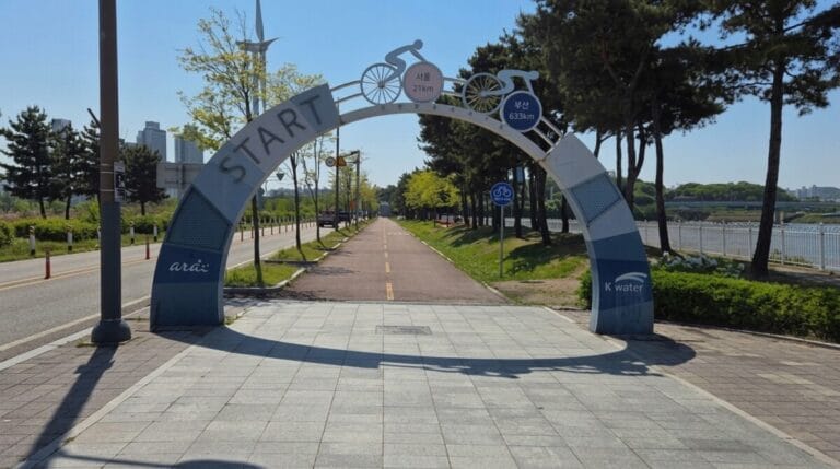
If you’ve been following this series through the beginner’s guide to Korea’s national cycling routes, the Ara Bicycle Path, the Hangang Bicycle Path, and the Saejae Bicycle Path, you’re now standing at the start of the longest single stretch in the entire network: the Nakdonggang Bicycle Path.
The Nakdonggang Bicycle Path runs roughly 385 kilometers along Korea’s longest river, and honestly, cramming it into one post would do it a disservice. So I’m splitting it the way most riders end up experiencing it anyway: an upper half from Sangju to the edge of Daegu, and a lower half from there down to Busan. This post covers the upper half of the Nakdonggang Bicycle Path, about 100 kilometers of weirs, rice country, and one genuinely nasty climb right out of the gate.
What the Nakdonggang Bicycle Path (Upper) Actually Is
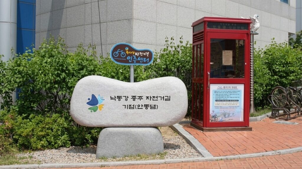
The Nakdonggang Bicycle Path picks up exactly where the Saejae Bicycle Path leaves off, at Sangju Sangpungyo Bridge, and follows the Nakdong River south. It’s the last of the four certified paths that make up Korea’s cross-country route, and it’s also the longest by a wide margin, roughly double the length of the Hangang Bicycle Path. Rather than try to cover the whole thing in one sitting, this post handles the upper section, from Sangju Sangpungyo down to Gangjeong-Goryeong Weir on the outskirts of Daegu. Part two picks up from there and runs the rest of the way to the sea.
Where the Saejae Bicycle Path was defined by two mountain passes, this stretch of the Nakdonggang Bicycle Path is defined by weirs. Four of the eight weirs built along the Nakdong River under the Four Rivers Restoration Project sit inside this section: Sangju Weir, Nakdan Weir, Gumi Weir, and Chilgok Weir, before the route ends at a fifth, Gangjeong-Goryeong Weir.
Each one was built with its own architectural theme, and riding from one to the next gives the whole stretch a rhythm that the mountain passes further north didn’t have.
There’s also a real technical detail worth knowing before you set off: Andong Dam, which shows up on a lot of Nakdong River maps and cycling guides, is not actually part of the national cross-country route. It sits about 70 kilometers upstream and only matters if you’re chasing the separate Four Rivers or Grand Slam certifications. If you’re following the cross-country route the way this series has been, from Incheon toward Busan, you can ignore it entirely and continue straight south from Sangju Sangpungyo.
Key Points on the Map
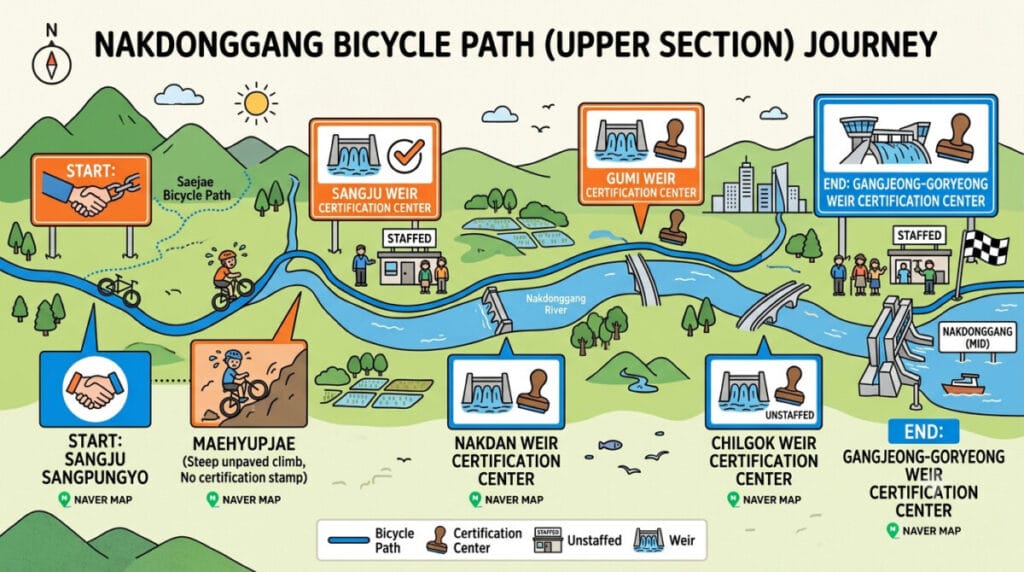
Here’s the lineup in the order you’ll reach them, with the certification stops marked:
- Sangju Sangpungyo (start, hands off from the Saejae Bicycle Path) — Naver Map
- Maehyupjae (steep unpaved climb, no certification stamp here) — Naver Map
- Sangju Weir Certification Center (staffed) — Naver Map
- Nakdan Weir Certification Center (staffed) — Naver Map
- Gumi Weir Certification Center (unstaffed) — Naver Map
- Chilgok Weir Certification Center (unstaffed) — Naver Map
- Gangjeong-Goryeong Weir Certification Center (end of this section, staffed) — Naver Map

Difficulty and How Long It Actually Takes
At just over 100 kilometers, this section of the Nakdonggang Bicycle Path sits between the Saejae and Hangang paths in length, and it’s easier to rate than either of them, because it’s really two different rides stitched together. The first 10 kilometers, from Sangju Sangpungyo to Sangju Weir, contain Maehyupjae, and after that, the terrain flattens out and stays flat almost the entire rest of the way to Gangjeong-Goryeong.
Estimates on Maehyupjae’s grade vary depending on who you ask, anywhere from 18 to 25 percent depending on the exact line you take, but everyone agrees on one thing: you’re walking it. The surface doesn’t help, either. It’s an unpaved farm road covered in loose stone and pine debris, not the clean asphalt you’d get on Ihwaryeong. If you’d rather skip it entirely, there’s a paved detour that crosses to the east bank of the river at Sangju Sangpungyo and rejoins the main route further down; it adds a little distance but saves you the ordeal.
Past Sangju Weir, riders sometimes run into a second, shorter rise on the way to Nakdan Weir, but nothing that compares to Maehyupjae. From there through Gumi Weir and Chilgok Weir, the path runs flat and straight along the riverbank, which makes for fast, easy kilometers but also a long, monotonous stretch with real gaps between places to stop. Most riders finish this section in a single day, somewhere around six to seven hours of actual riding time, though the flat sections make it easy to bank extra distance if you’re combining it with part of the next leg.
The Certification Centers on the Nakdonggang Bicycle Path (Upper)
There are five certification stops in this section, and unlike the Saejae Bicycle Path, the staffed and unstaffed centers alternate rather than clustering at the ends. Plan your rest stops accordingly.
Sangju Sangpungyo to Sangju Weir: The Steepest Grade on the Route
Sangju Sangpungyo itself has fairly little around it, just a certification booth and a bathroom, so if you’re arriving fresh rather than continuing straight off the Saejae Bicycle Path, don’t expect to find breakfast here. The bridge marks the meeting point of two paths, the cross-country route heading toward Sangju Weir on the west bank, and a separate Nakdong River trail on the east bank that avoids Maehyupjae entirely by routing through farmland instead.
Sangju Weir Certification Center is staffed, open Tuesday through Saturday from 9am to 6pm, and this is where you’ll want to buy your bike passport if you’re just joining the route here. The weir itself is one of the more understated ones on the Nakdong, with a straightforward design that doesn’t try to compete with some of the more elaborate structures further downstream.
Sangju Weir to Nakdan Weir: Past the Bicycle Museum
This stretch runs past two of the section’s genuine highlights, Gyeongcheondae and the Sangju Bicycle Museum, both worth a slower look than most riders give them on the way through. Nakdan Weir Certification Center is also staffed, same hours as Sangju Weir, and there’s a convenience store and a restaurant about a hundred meters past the booth. A bowl of ppyeo-haejangguk, a bone broth soup built for exactly this kind of hangover-from-exercise moment, tends to hit differently after a morning like this one.
Nakdan Weir to Gumi Weir: The Long Flat Stretch
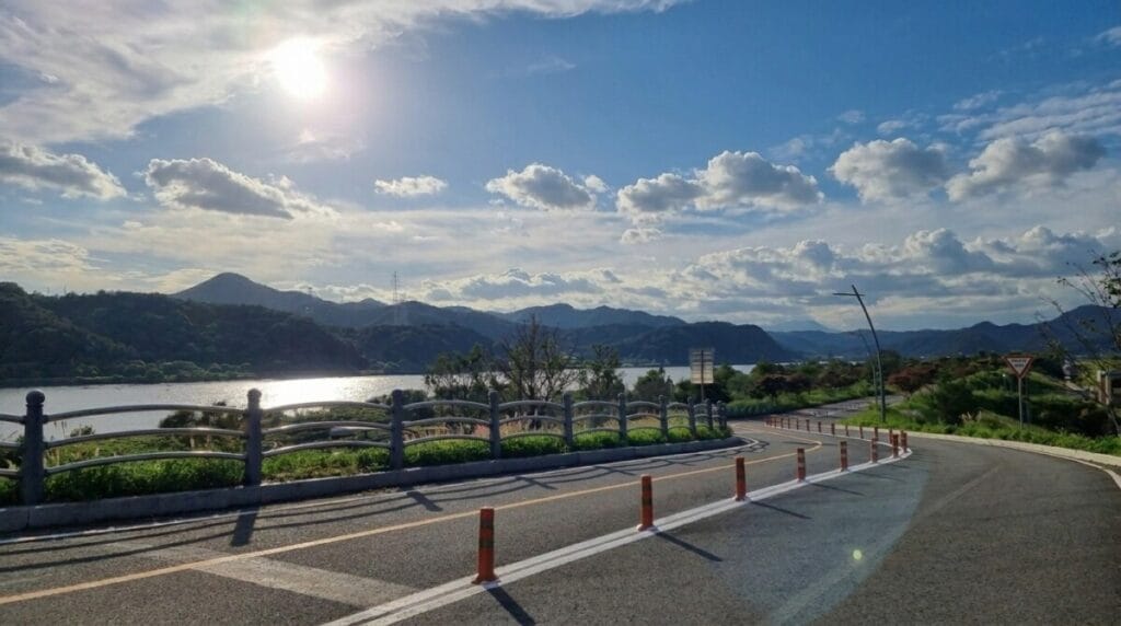
Gumi Weir is arguably the most photogenic structure on this entire section, with towers shaped like two dragons and a turtle, symbols of wisdom and longevity in Korean tradition, and an observation deck built into the turtle’s shell with a 360-degree view over the river. Functionally, though, the certification center here has gone downhill in recent years. Riders report that the vending machine has been removed and amenities are thin, so treat Nakdan Weir as your last reliable resupply point before Gumi and plan to push on to Chilgok if you need anything more substantial.
Gumi Weir to Gangjeong-Goryeong Weir: Into the Daegu Suburbs
The last stretch of this section is the longest between certification stops, and it stays flat and fast along the riverbank the entire way. Chilgok Weir’s certification booth is unstaffed but still has a vending machine and bathroom according to recent rider reports, and the town of Waegwan, a short detour off the path, has a full range of restaurants if you need a proper sit-down meal.
Near the end of this section, older route notes mention a climb over Daramjae, a hill near Dodong Seowon with grades reported above 10 percent. That climb has largely been bypassed: a tunnel now runs beneath Daramjae, letting most riders skip the hill entirely and roll straight through toward Gangjeong-Goryeong Weir, which closes out this section, staffed daily from 9am to 5:30pm, and marks the edge of Daegu’s Seongseo district.
Do You Need a Place to Sleep on This Section?
At around 100 kilometers with mostly flat terrain after Maehyupjae, strong riders can finish this section of the Nakdonggang Bicycle Path in a single day without much trouble, especially if they treat the climb as the morning’s main event and settle into a steady pace afterward. That said, splitting it is common, particularly for riders who crossed Ihwaryeong on the Saejae Bicycle Path the day before and don’t want three demanding days in a row.
Nakdan Weir has lodging nearby and makes a sensible midpoint stop. Gumi city itself sits a few kilometers off the main path, and Seonsan, a smaller town near Gumi Weir, has accommodation about 5 kilometers from the certification center if you don’t mind a short detour. Chilgok Weir also has lodging within reach, though it takes some navigating to find. If you’d rather push all the way through, Gangjeong-Goryeong Weir connects directly into Daegu’s Seongseo district, which has by far the widest range of hotels and guesthouses on this entire section.
Where to Eat Along the Way
Sangju is worth knowing about before you even start pedaling. Locals call it “the town of three whites,” for its rice, silk, and dried persimmons, and if you’re passing through in autumn, strings of goam, Sangju’s famous dried persimmons, hanging outside farmhouses along the route are a common sight. It’s a nice reminder that this stretch runs through some of Korea’s most productive rice country, not just weir infrastructure.
Once you’re past Sangju Weir, food options thin out considerably until Nakdan Weir, where the convenience store and restaurant near the certification booth make for a natural lunch stop. Between Nakdan and Chilgok, don’t count on much, since Gumi Weir’s amenities have declined and the path stays well outside Gumi city itself.
Waegwan, just off the Nakdonggang Bicycle Path near Chilgok, has a proper selection of restaurants if you need something more substantial than convenience store food. Once you reach Gangjeong-Goryeong Weir, Daegu’s Seongseo district opens up into full city dining, including a few spots locally known for their seasoned rotisserie chicken, a good way to reload protein after a long, flat afternoon.
Getting to the Starting Point
If you’re continuing straight from the Saejae Bicycle Path, you’re already at the start, since Sangju Sangpungyo is the certification center where that route ends.
If you’re starting fresh, Sangju is reachable by intercity bus from Seoul’s Nambu Bus Terminal, though the ride takes a while given the distance south. A faster option for many foreign riders is taking the KTX to Gumi and cycling north to Sangju Sangpungyo first, then turning around to ride the section properly southbound; Gumi Station sits close enough to the bike path to make this a practical option, and it saves a long bus ride if your schedule is tight.
Worth Slowing Down For
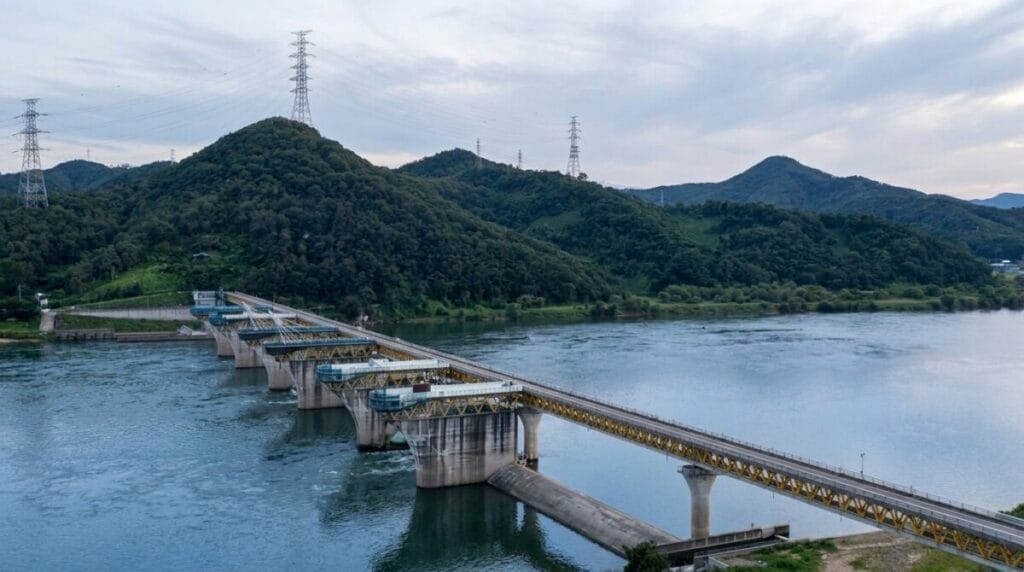
Gyeongcheondae deserves more time than most riders give it. The name translates roughly to “a platform so beautiful it startles heaven,” and the viewpoint over a bend in the Nakdong River backs that up, with cliffs on one side and a wide sandy bank on the other. It’s consistently ranked among the most scenic stretches on the entire cross-country route, and there’s a short, punishing cement climb up to the overlook that’s separate from Maehyupjae, so budget a little extra effort if you want the view.
The Sangju Bicycle Museum, just past Gyeongcheondae, is a genuinely odd little detour: an entire museum dedicated to the history and mechanics of the bicycle, sitting in the middle of rural Gyeongsangbuk-do. Most of the exhibits are in Korean, but there’s enough hands-on material, old frames, working models, historical photos, to make a twenty-minute stop worthwhile even if you can’t read a word of it.
Right nearby, Donam Seowon, a Confucian academy dating back centuries, offers a quieter, older kind of history if temples and academies are more your speed than bicycle trivia.
And if you want a closer look at the engineering, Gumi Weir’s dragon-and-turtle towers and Gangjeong-Goryeong Weir’s twelve cables, designed to evoke the strings of a gayageum, Korea’s traditional zither, are both worth a proper stop rather than a passing photo. The Four Rivers Project gets plenty of criticism in Korea for its cost and environmental impact, but there’s no denying the designers put real thought into making each weir look distinct.
Quick Summary
Here’s this section of the Nakdonggang Bicycle Path at a glance, from Sangju Sangpungyo to Gangjeong-Goryeong Weir.
- Distance: about 100 km, the first half of the roughly 385 km Nakdonggang Bicycle Path
- Time: about 6–7 hours of riding, mostly flat after the first 10 km
- Difficulty: moderate overall, but includes the steepest single grade on the entire cross-country route
- Stamps: 5 total, staffed at Sangju Weir, Nakdan Weir, and Gangjeong-Goryeong Weir; unstaffed at Gumi Weir and Chilgok Weir
- Climbs: Maehyupjae, an 18–25% unpaved grade right out of Sangju Sangpungyo, steeper than Ihwaryeong on the Saejae Bicycle Path
- Lodging: Nakdan Weir or Seonsan near Gumi make sensible midpoint stops; Daegu’s Seongseo district has the widest range if you push through to the end
- Food: Sangju is famous for rice and dried persimmons; reliable stops at Nakdan Weir and Waegwan, thin between Gumi and Chilgok
- Access: continue directly from the Saejae Bicycle Path at Sangju Sangpungyo, or take the KTX to Gumi and ride north to start
- Watch for: a paved detour around Maehyupjae exists if you’d rather skip the climb, and Gumi Weir’s amenities have thinned out, so resupply at Nakdan Weir before pushing on
The Nakdonggang Bicycle Path doesn’t announce itself the way Ihwaryeong or Sojo Pass did. It just quietly makes you walk your bike up a hill with no warning, then flattens out and lets you coast past weirs shaped like dragons for the rest of the afternoon. Next up: the lower half of the Nakdonggang Bicycle Path, past Daegu and through two of the toughest climbs on the whole cross-country route, all the way to where the river meets the sea in Busan.