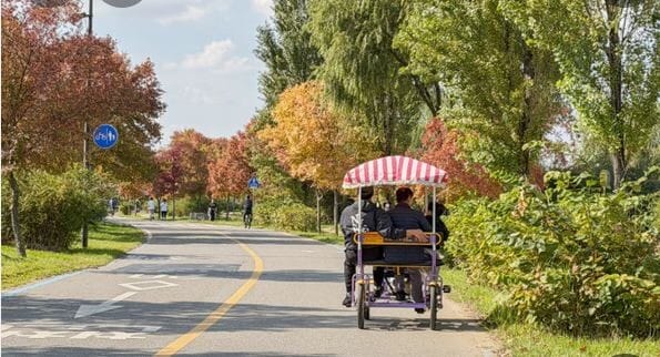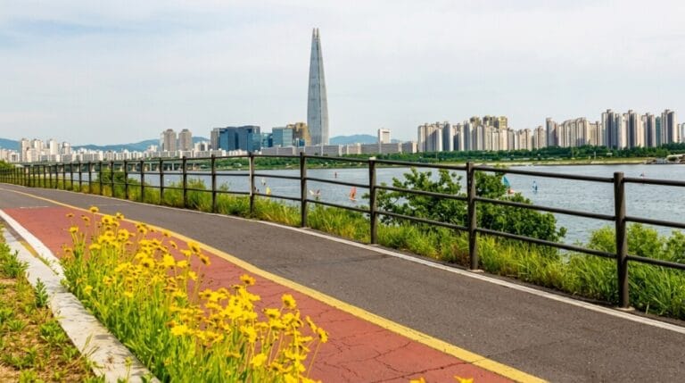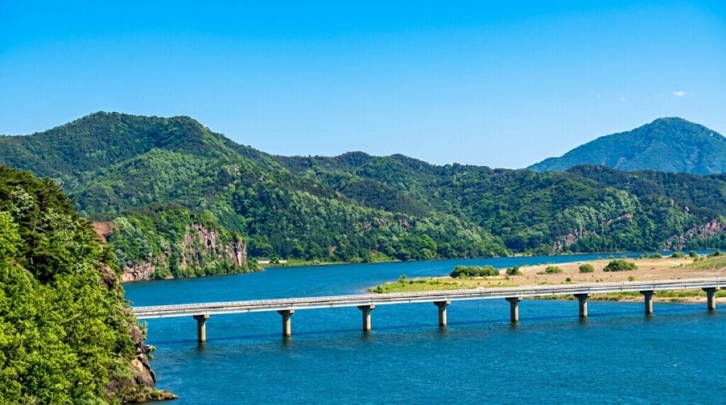
Somewhere around kilometer 140, with my water bottle down to the last warm mouthful and no convenience store in sight for the third hour running, I finally understood why Korean riders have a nickname for this stretch of the Nakdonggang Bicycle Path: 낙동사막, the Nakdong Desert. It’s not a real desert, obviously. It’s rice paddies and riverbank and the occasional shuttered snack stand with its shutters down. But after the reliable rhythm of a convenience store every few kilometers on the Hangang Bicycle Path, the silence out here feels like one.
This is the finale. If you’ve followed this series through the beginner’s guide to Korea’s national cycling routes, the Ara Bicycle Path, the Hangang Bicycle Path, the Saejae Bicycle Path, and the upper half of the Nakdonggang Bicycle Path, this post takes you the rest of the way. About 190 kilometers from Gangjeong-Goryeong Weir on the edge of Daegu down to the Nakdong River Estuary Barrage, where the river finally meets the sea in Busan.
Korean cyclists rate the Nakdonggang Bicycle Path (Lower) as the hardest single section of the entire cross-country route. Not the steepest, not the longest single day, but the most relentless. Here’s what to expect.
What the Nakdonggang Bicycle Path (Lower) Actually Is
The Nakdonggang Bicycle Path is the last of the four certified paths that make up Korea’s national cross-country route, and this lower half is where it earns its five-star difficulty rating. Where the upper section of the Nakdonggang Bicycle Path was mostly flat riverbank between weirs, this half packs in three of what Korean riders call the “Four Great Climbs of the Nakdong,” a set of passes that show up on nearly every rider’s blog as the toughest test of the whole 633-kilometer journey.
The route continues south from Gangjeong-Goryeong Weir, passing four more of the Nakdong River’s weirs before reaching the coast: Dalseong Weir, Hapcheon-Changnyeong Weir, and Changnyeong Haman Weir, followed by a certification stop at the Yangsan Culture Hall and the final stamp at the Nakdong River Estuary Barrage itself. That last stamp isn’t just the end of the Nakdonggang Bicycle Path. It’s the finish line for the entire cross-country route from Incheon.
Key Points on the Map
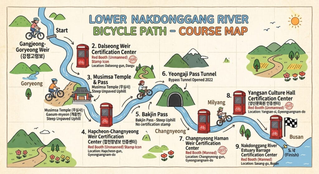
Here’s the lineup in the order you’ll reach them, with the certification stops marked:
- Gangjeong-Goryeong Weir (start, hands off from the upper Nakdonggang Bicycle Path) — Naver Map
- Dalseong Weir Certification Center (unstaffed) — Naver Map
- Musimsa Pass (steep unpaved climb, temple detour, no certification stamp) — Naver Map
- Hapcheon-Changnyeong Weir Certification Center (unstaffed) — Naver Map
- Bakjin Pass (unavoidable climb, no certification stamp) — Naver Map
- Yeongaji Pass (mostly tunneled since 2022, no certification stamp) — Naver Map
- Changnyeong Haman Weir Certification Center (staffed) — Naver Map
- Yangsan Culture Hall Certification Center (unstaffed) — Naver Map
- Nakdong River Estuary Barrage Certification Center (end of the entire cross-country route, staffed) — Naver Map
Difficulty and How Long It Actually Takes
At roughly 190 kilometers, the Nakdonggang Bicycle Path (Lower) is the longest single section in the entire series, and Korean cycling forums consistently rank it as the hardest stretch of the whole route, harder even than Maehyupjae on the upper half. It’s not one dramatic climb. It’s three real ones packed into the middle 60 kilometers, with long, exposed, amenity-free riding on either side.
Musimsa Pass has an unpaved surface with grades reported near 20 percent over about 1.7 kilometers, though an official paved detour exists if you’d rather skip it. Bakjin Pass cannot be avoided; it’s roughly 1.3 kilometers with pitches up to 13 percent on open road, and riders consistently rate it as harder than Ihwaryeong on the Saejae Bicycle Path despite the shorter distance. Yeongaji Pass used to be the worst of the three, a rough, pine-needle-covered mountain trail, but two tunnels opened in 2022 that bypass most of the old climb.
Given the distance and the terrain, most riders split this section of the Nakdonggang Bicycle Path across two days rather than pushing straight through. A single strong rider can do it in one long day, something like ten to eleven hours in the saddle, but two easier days with an overnight around Namji make for a much less miserable experience.
The Certification Centers on the Nakdonggang Bicycle Path (Lower)
There are five new certification stops on the Nakdonggang Bicycle Path (Lower). Only Changnyeong Haman Weir and the final stamp at the estuary barrage are staffed; the rest are self-serve booths.
Gangjeong-Goryeong Weir to Dalseong Weir: The Calm Before the Climbs
This opening stretch is deceptively gentle, riverside riding with a small pink muhly grass field near Dalseong Weir that’s become something of an unofficial photo stop for riders passing through in autumn. Dalseong Weir Certification Center is unstaffed, but Hyeonpung, just off the path, has a proper intercity bus terminal with restaurants nearby if you want a real meal before the climbing starts.
Dalseong Weir to Hapcheon-Changnyeong Weir: Musimsa Pass
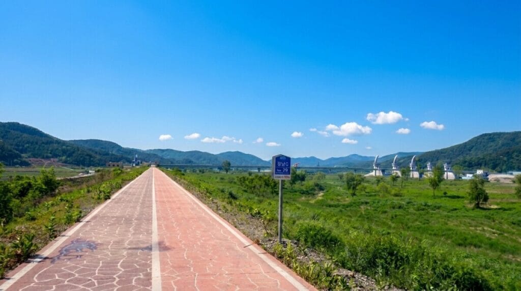
This is the first of the Nakdonggang Bicycle Path’s real tests. Musimsa Pass climbs a rough forest road to a small mountain temple, and the surface is bad enough that most guides recommend the paved detour unless you’re specifically curious. If you do climb it, the temple at the top offers free vegetarian meals to visitors, a nice, quiet reward after a nasty grade. Hapcheon-Changnyeong Weir Certification Center on the other side is unstaffed, with a convenience store nearby for restocking.
Hapcheon-Changnyeong Weir to Changnyeong Haman Weir: The Hardest 51 Kilometers
Korean riders call this the toughest stretch on the entire Nakdonggang Bicycle Path, and by extension, the toughest on the whole cross-country route. It’s not just the distance. Bakjin Pass sits partway through, unavoidable and steeper than it looks on paper, and its summit has become something of a pilgrimage site, with rider graffiti covering the guardrails and a genuinely great panoramic view over the river as your reward.
Not far past Bakjin Pass comes Yeongaji Pass, historically the section’s most miserable climb, a rough mountain trail scattered with pine needles. Two tunnels opened in 2022 now let most riders skip the worst of it, cutting what used to be a long, grinding detour down to about 10 kilometers of well-lit, low-traffic tunnel road.
Jeokpo intersection, roughly two-thirds of the way through this stretch, is your last reliable food stop before Changnyeong Haman Weir, so it’s worth pulling in even if you’re not hungry yet. Namji, a proper town just past Yeongaji Pass, is where most riders choose to rest, restock, or spend the night before continuing.
Changnyeong Haman Weir to Yangsan Culture Hall: Hwangsan Berang-gil
After the climbing, this stretch of the Nakdonggang Bicycle Path is a genuine reward. Changnyeong Haman Weir Certification Center is staffed, with a small store and rest area worth using. From there, the path runs along Hwangsan Berang-gil, a wooden deck trail squeezed between the river and the railway that’s regularly named among Korea’s hundred most beautiful bicycle paths. Yangsan Culture Hall’s certification booth is unstaffed but marks the point where the terrain flattens out for good.
Yangsan Culture Hall to the Nakdong River Estuary Barrage: The Finish Line
The last stretch is flat, fast, and increasingly urban as the route approaches Busan. Near Gimhae, an old climb called Mojeong Pass used to be one of the trip’s final obstacles; a converted rail tunnel now carries riders straight through instead. From there, it’s a straight shot to the Nakdong River Estuary Barrage, where the staffed certification center marks not just the end of the Nakdonggang Bicycle Path, but the completion of Korea’s entire cross-country cycling route.
Do You Need a Place to Sleep on This Section?
Given the length and the three climbs packed into the middle, splitting the Nakdonggang Bicycle Path (Lower) across two days is the norm rather than the exception. Namji is the natural overnight stop, sitting just past the hardest stretch, with a real range of lodging and restaurants after a long day with almost none.
Changnyeong’s town center, a short detour before Musimsa Pass, is another option if you’d rather break the ride earlier and tackle all three climbs fresh the next morning. If you’re pushing straight through in one day, Busan itself has every lodging option imaginable once you arrive, which makes it easy to reward yourself properly at the finish.
Where to Eat Along the Way
The Nakdonggang Bicycle Path (Lower) genuinely earns its “Nakdong Desert” nickname when it comes to food. Hyeonpung, near Dalseong Weir, is a reliable stop with a full range of restaurants around the bus terminal. Past that, options get thin fast.
Musimsa’s temple offers free vegetarian meals if you make the climb, though it’s worth calling ahead. Jeokpo intersection has a small restaurant that’s become something of a legend among cross-country riders for its spicy stir-fried pork, and it’s genuinely your last real meal option before Changnyeong Haman Weir. Namji has the widest selection along this entire stretch of the Nakdonggang Bicycle Path, full restaurants, cafes, and convenience stores, which is another reason it works so well as an overnight stop. Once you reach Busan, obviously, food stops being a concern entirely.
Getting to the Starting Point
If you’re continuing straight from the upper half of the Nakdonggang Bicycle Path, you’re already at Gangjeong-Goryeong Weir, right where this section begins.
If you’re starting fresh, Gangjeong-Goryeong Weir sits close to Daegu, reachable by taking the KTX to Dongdaegu Station and cycling or taking local transit the rest of the way. And since this section ends the entire cross-country route in Busan, getting home afterward is easy. Busan has a major KTX station and an international airport, so whichever direction you’re heading next, you won’t have any trouble finding a way there.
Worth Slowing Down For
Bakjin Pass’s summit is worth a proper stop even though the climb itself is brutal. This is the emotional high point of the whole Nakdonggang Bicycle Path (Lower): riders have been leaving graffiti and messages on the guardrails for years, and reading through them while catching your breath, with the whole Nakdong River spread out below, is one of the more memorable moments on the entire cross-country route.
Hwangsan Berang-gil, the wooden deck path after Changnyeong Haman Weir, deserves a slower pace than most riders give it after the climbs behind them. It’s a genuinely gorgeous stretch, squeezed between cliffside and river, and it’s earned its spot among Korea’s officially recognized most beautiful bike paths.
And at the very end, the Nakdong River Estuary itself is worth lingering at beyond just the certification stamp. Eulsukdo, the island where the river meets the sea, is one of Korea’s most significant wetland habitats, a major stopover for migratory birds and home to an eco center if you want to learn more before heading into Busan proper.
Quick Summary
Here’s the Nakdonggang Bicycle Path (Lower) at a glance, from Gangjeong-Goryeong Weir to the Nakdong River Estuary Barrage.
- Distance: about 190 km, the second half of the roughly 385 km Nakdonggang Bicycle Path, and the final section of Korea’s entire cross-country route
- Time: about 10–11 hours in one push, though most riders split it across two days
- Difficulty: five stars, widely considered the hardest single section of the whole cross-country route
- Stamps: 5 total, staffed only at Changnyeong Haman Weir and the Nakdong River Estuary Barrage; unstaffed at Dalseong Weir, Hapcheon-Changnyeong Weir, and Yangsan Culture Hall
- Climbs: Musimsa Pass (steep, detourable), Bakjin Pass (unavoidable, steeper than Ihwaryeong), Yeongaji Pass (mostly tunneled since 2022)
- Lodging: Namji is the standard overnight stop, right after the hardest climbing; Changnyeong town center works if you’d rather split the ride earlier
- Food: genuinely thin between Hyeonpung and Namji, earning this stretch its “Nakdong Desert” nickname; stock up whenever you see the chance
- Access: continue directly from the upper Nakdonggang Bicycle Path at Gangjeong-Goryeong Weir, or take the KTX to Dongdaegu Station to start fresh
- Watch for: carry more water than feels necessary through the middle 60 km, and don’t skip Jeokpo intersection even if you’re not hungry yet, it’s your last real food stop before Changnyeong Haman Weir
That’s the Nakdonggang Bicycle Path, and with it, the whole cross-country route from Incheon to Busan. Five posts, four bicycle paths, one country crossed end to end. If you’ve ridden the whole thing following this series, congratulations, you’ve earned whatever you order for dinner tonight in Busan. And if you’re only just starting to plan your own crossing, I hope this series gave you enough of a head start to enjoy it as much as I did, brutal climbs and all.