I still remember the first time a foreign rider messaged me asking how on earth he was supposed to get his bicycle passport stamped at an unmanned certification center in the middle of nowhere, with no staff, no signage in English, and an ink pad so dry it left nothing but a faint gray smudge. He had flown in from Germany with a plan he’d built entirely from blog posts and forum threads, and half of what he’d read turned out to be either outdated or written for someone who already spoke Korean.
That conversation is basically why this series exists. Korea’s national cross-country cycling routes, known here as guktojongju, stretch across more than 1,800 kilometers of river paths, converted railways, and coastal roads, and they’re some of the best-maintained long-distance cycling infrastructure anywhere in the world. But almost everything written about them assumes you already know how the country works. Before we get into any specific route, I want to walk you through the practical groundwork: how the passport and stamp system actually functions, how to navigate without getting routed into a highway, where your money will and won’t work, and what to do the day something goes wrong. Get this part right and the rest of the trip takes care of itself.
The Twelve Routes: What “Guktojongju” Actually Covers
Before any of the practical tips make sense, it helps to know what you’re actually looking at. “Guktojongju” isn’t a single trail. It’s a certification system covering twelve separate bicycle paths, together stretching about 1,857 kilometers, built mostly along the country’s major rivers and coastlines. Riders rarely tackle all twelve in one trip. Instead, people tend to group them into a handful of standalone journeys and pick the one that fits the time they have. Here’s the full lineup, numbered to match the official map.

| No. | Route (English name) | Length | Start → End |
|---|---|---|---|
| 01 | Bukhangang Bicycle Path | 70 km | Balgeun Plaza, Seoul → Sinmae Bridge, Chuncheon |
| 02 | Ara Bicycle Path | 21 km | Ara West Sea Lock → Ara Hangang Lock |
| 03 | Ocheon Bicycle Path | 105 km | Haengchon Crossroad → Hapgang Park |
| 04 | Geumgang Bicycle Path | 146 km | Daecheong Dam → Geumgang Estuary Bank |
| 05 | Yeongsangang Bicycle Path | 133 km | Damyang Dam → Yeongsangang Estuary Bank |
| 06 | Seomjingang Bicycle Path | 149 km | Seomjingang Sports Park, Imsil → Baealdo Waterside Park, Gwangyang |
| 07 | Jeju Circumnavigation Bicycle Path | 234 km | Full loop of Jeju Island’s coastline |
| 08 | East Sea Bicycle Path (Gangwon section) | 242 km | Unification Observatory, Goseong → Gopo Village, Samcheok |
| 09 | East Sea Bicycle Path (Gyeongbuk section) | 76 km | Eunobridge, Uljin → Haemaji Park, Yeongdeok |
| 10 | Hangang Bicycle Path | 192 km | Ara Hangang Lock → Chungju Dam |
| 11 | Saejae Bicycle Path | 100 km | Tangeumdae, Chungju → Sangpunggyo, Sangju |
| 12 | Nakdonggang Bicycle Path | 385 km | Sangpunggyo, Sangju → Nakdonggang Estuary Bank, Busan |
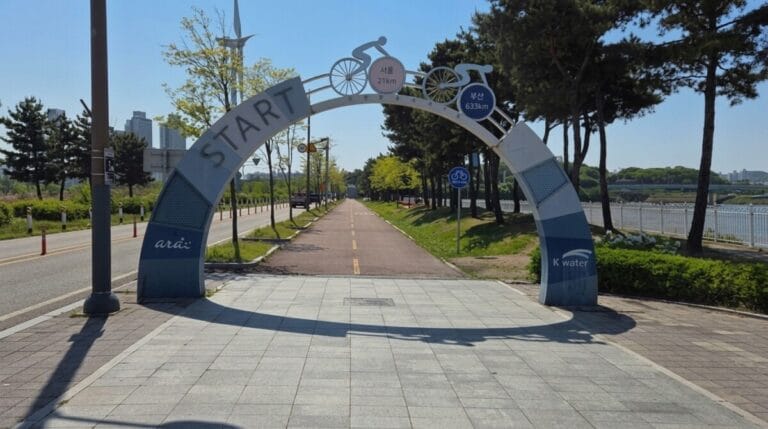
Most riders don’t take on all twelve. The classic combination is routes 02, 10, 11, and 12 strung together, which forms the main cross-country line from Incheon to Busan at roughly 633 kilometers. Everything else tends to get ridden as its own separate trip: 03 and 04 together through the Geumgang basin, 05 and 06 through the southwest, 08 and 09 down the east coast, 07 as a standalone loop around Jeju, and 01 as a quick branch out of Seoul. Once you know which of these you’re doing, the rest of the planning, including which certification centers to look for, follows naturally.
1. The Core Cross-Country Route (Seoul to Busan Alliance)
If you want to complete the legendary 633km cross-country journey from the capital to the southern port city of Busan, you will be linking these trails together:
- 02. Ara Bicycle Path (아라자전거길)
- 10. Hangang Bike Path (한강종주자전거길)
- 11. Saejae Bicycle Path (새재자전거길)
- 12. Nakdonggang Bike Path (낙동강자전거길)
2. Regional Scenic Trails (The Inland Rivers)
If you want a quieter, more culturally immersive experience away from the heavy crowds, Korea’s regional river paths offer incredible historical backdrops:
- 01. Bukhangang Bike Path (북한강자전거길)
- 03. Ocheon Bicycle Path (오천자전거길)
- 04. Geumgang Bike Path (금강자전거길)
- 05. Yeongsangang Bike Path (영산강자전거길)
- 06. Seomjingang Bike Path (섬진강자전거길)
3. Coastal Outliers (The Ocean Views)
For those who prefer the sound of crashing waves over rushing river waters:
- 08 & 09. East Coast Bicycle Path (동해안자전거길)
- 07. Jeju Fantasy Bicycle Path (제주환상자전거길)
Getting Your Bicycle Passport and Stamps Sorted
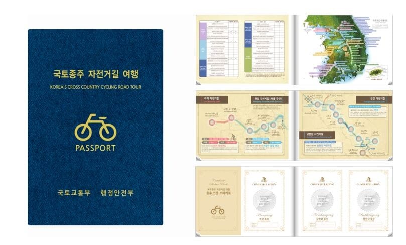
The stamp collecting system is what turns this from a simple bike ride into something closer to a pilgrimage, and it’s genuinely one of the more charming parts of touring Korea. Each certification center along the route has a stamp waiting for you, and filling every page of your passport earns you an official completion certificate at the end. The catch is that almost no English guide tells you where to actually buy the thing before you start.
Where to Buy the Physical Passport
You can pick one up at any of the major certification centers rather than hunting down a specialty shop beforehand. The Ara West Sea Lock Certification Center at the western end of the Ara Bicycle Path and the Gwangnaru Information Center along the Hangang course are both easy starting points, well signed, and used to seeing foreign riders. Expect to pay somewhere in the range of a few thousand won, and bring cash just in case the card reader is having one of its off days.
The Digital Option: An App Instead of a Booklet
If you’d rather not carry a paper booklet for two weeks, there’s a certification app that logs your stamps digitally through GPS check-ins at each location. It works well once it’s set up, but foreign visitors sometimes run into friction during account verification, since a few of the sign-up steps assume a Korean phone number. If you’re traveling with a Korean SIM or an eSIM registered locally, it tends to go smoothly. If not, the paper passport is the more reliable route, and honestly, there’s something satisfying about a physical page stamped forty times over that a phone screen just can’t replicate.
Tip for Foreigners:
- How to Search: Search for “자전거 행복나눔” or “Bicycle Happiness Sharing” in the Google Play Store or Apple App Store.
- The Sign-up Issue: The app requires a Korean phone number verification to register. If you only have a data-only eSIM without a local voice/text number, you won’t be able to create an account.
- The Backup Plan: If the app setup fails, simply purchase the physical “Certification Passport” (인증수첩) for 4,000 KRW at major manned certification centers or online beforehand. It works everywhere and requires no internet or phone number.
Bring Your Own Ink Pad
This is the one piece of gear nobody mentions until it’s too late: pack a small ink pad from Daiso before you leave the city. A huge number of the stamp pads sitting at these certification centers have been baked in the sun for years, and by the time you arrive the ink has usually dried to almost nothing or the rubber stamp itself has worn smooth from thousands of hands pressing down on it. Riders who find out about this trick after the fact tend to feel a very specific kind of regret, staring at a blank page where a stamp should be.
Why Google Maps Will Let You Down
This is the single biggest adjustment for most visitors, and it’s worth saying plainly: Google Maps navigation, especially cycling directions, does not function properly in Korea. Turn-by-turn guidance frequently breaks down mid-route, paths that clearly exist on the ground don’t show up at all, and you can end up rerouted onto a stretch of highway that no cyclist should ever be on. This isn’t a minor quirk, it’s a legal restriction on detailed mapping data that has never been fully resolved, and it catches almost every first-time visitor off guard.
Switching Naver Map to English
Naver Map is what actually works here, and it supports an English interface, which makes the switch far less painful than people expect. Open the app, tap the settings menu, usually reached through your profile icon in the corner, and look for the language option to change it from Korean to English. Once it’s set, place names, directions, and search results all display in English, and you can search for restaurants or convenience stores along your route the same way you would on any map app back home.
Dedicated Bike Paths Versus Shared Roads
Not every kilometer of the national route runs on a fully separated bike path. In several stretches, particularly around smaller towns and certain mountain passes, the dedicated path ends and you’re funneled onto a regular road shared with cars and farm trucks. These sections aren’t dangerous if you’re paying attention, but they do call for a shift in mindset. Stay alert, ride single file if you’re in a group, and treat these as the moments to slow down rather than the moments to push your average speed.
Money, Food, and a Place to Sleep
The countryside runs on a different rhythm than Seoul, and nowhere is that clearer than at the checkout counter.
Cash Still Rules Outside the Cities
Apple Pay and foreign Visa or Mastercard don’t always work at small rural restaurants, convenience stores, or even at Daiso when you’re grabbing that ink pad. Carry a reasonable amount of cash for anything off the main tourist track. If you need to withdraw more, look for convenience store chains like GS25 or CU, since most branches have an ATM inside, and these are far easier to find in small towns than a standalone bank.
Asking for Bike-Friendly Lodging
For anyone touring with an expensive bike, the question of where it sleeps at night matters as much as where you do. Most motels and guesthouses along the route are happy to let you bring your bicycle into the room, but it helps to ask directly rather than assume. A useful phrase is “jajeongeoreul bang ane deuryeonoado doelkkayo?” which means “may I bring my bicycle into the room?” Most owners will say yes without hesitation, and many have already dealt with touring cyclists before.
Eating Alone Without the Awkward Stare
Some countryside restaurants, especially ones serving spicy fish stew or whole chicken dishes, only take orders for two people or more, which can leave a solo rider stuck. Dishes like gukbap, a rice and soup combination, or bibimbap, mixed rice with vegetables, are almost always available as a single serving and make a reliable fallback when you’re riding solo. It’s also worth glancing for a bike rack or a solid railing out front before you sit down, since not every countryside restaurant has somewhere safe to lock up.
Restrooms and Water: Korea’s Quiet Superpower
If you’ve toured through Europe or the American countryside, you already know the low-grade anxiety of not knowing where the next bathroom is, or having to pay for one when you find it. Korea flips that expectation entirely. Public restrooms line the cycling paths at regular intervals, they’re free, and they’re generally clean enough that you won’t think twice about using them.
Water is just as easy. Most certification centers, parks, and restaurants along the route have a water purifier where you can refill your bottle for free, which tends to genuinely surprise first-time visitors. If you want to top up at a restaurant, the phrase to use is “mul jom damaga do doelkkayo?”, meaning “can I refill my water bottle?”
Local Riding Rules and Etiquette
Every country has its own unwritten rules of the road, and Korea’s are worth knowing before you clip in.
Trying Out Seoul’s Public Bike, Ttareungyi
If you only want a light ride along the Hangang without touching the full national route, Seoul’s public bike system, called Ttareungyi, is worth trying. Foreign visitors can rent through the mobile app using an international card, and stations are scattered densely enough along the river that you’re rarely far from one.
Lights, Stealth Riders, and the Helmet Rule
Korea’s cycling paths stay busy well into the evening thanks to how safe the country generally feels, but that also means you’ll encounter what local riders jokingly call “stealth riders,” cyclists gliding along at night with no lights at all. Front and rear lights aren’t optional here if you’re riding after dusk, both for your own visibility and to spot the riders who forgot theirs. Helmets are technically required under Korean law, though enforcement is loose, and wearing one is simply the smarter call on long, unfamiliar stretches.
When Something Goes Wrong
Most tours go smoothly, but it helps enormously to know what your options are on the day they don’t.
Calling a Truck When Your Bike Can’t Go On
If your frame cracks or a mechanical failure leaves you unable to continue, locals in this situation often call a one-ton cargo truck service, similar to a local courier or moving van, to transport themselves and the bike to the nearest city. Ride-hailing apps like Kakao T can arrange a taxi large enough for a bike in a pinch, and asking your accommodation host to help call a cargo truck service is a reliable backup if the app interface is giving you trouble in English.
Reading the Distance Markers
Along the path you’ll notice small marker posts showing a number and the distance to the nearest reference point. If you’re ever in an emergency, take a photo of the nearest marker before calling for help. Reading that number to emergency services or showing it to anyone nearby pinpoints your location far faster than trying to describe where you are.
Choosing Your Season
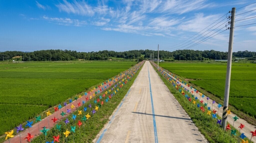
Timing your trip matters more in Korea than in most places. The monsoon season hits hard in July and August, and sections of the route regularly flood and close during heavy rain. Winter brings its own problems, with icy patches that make the paths genuinely unsafe. May through June and September through October are the sweet spot, with mild temperatures, dry weather, and scenery that makes every rest stop worth stretching a little longer.
Before You Clip In: Three Apps to Download
Load these onto your phone before you leave your hotel on day one:
- Naver Map, switched to English, for navigation that actually works
- Papago, for real-time translation when a phrase card won’t cut it
- The national cycling route certification app, as a digital backup to your paper passport
None of this is meant to make the trip sound complicated. If anything, once you know these few things going in, Korea turns out to be one of the easiest countries in the world to tour by bike. The paths are smooth, the restrooms are everywhere, and the countryside has a way of slowing your thoughts down to match the pace of the pedals. In the next post, we’ll start working through the individual routes themselves, beginning with the Ara Bicycle Path.